EarthToDate
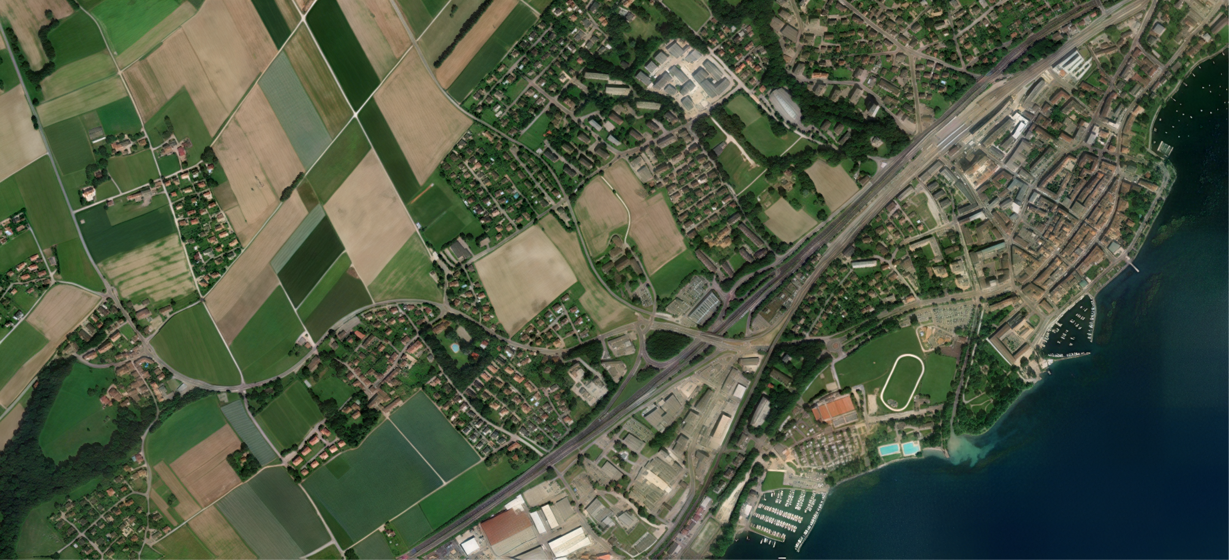
EarthToDate delivers weekly high-resolution satellite images of the entire world, allowing users to monitor any area and make real-time decisions with precise, up-to-date data.
EarthToDate is our primary satellite imaging service, delivering high quality images, updated weekly of the entire world. This service provides high-resolution data, allowing users to monitor any area of any size with exceptional clarity, track changes over time, and make informed decisions in real-time.
With EarthToDate, you can stay up to date on the latest developments affecting your area of interest, giving you a competitive advantage by accessing timely and precise information. EarthToDate is the only service with a fresh image of the whole world at high resolution every week.
Applications
Defense
Improve situational awareness, monitor border activities, and track changes in areas of strategic interest.Defense analysts can use our satellite data to gain a clearer understanding of large regions and maintain up-to-date information on potential threats.
Agriculture
Monitor crop health, assess water requirements, and predict yield outcomes with high-resolution NDVI, other indices and true-color imagery.
With EarthToDate, farmers can make better decisions about irrigation, pest control, and harvest timing, ultimately leading to higher productivity and more sustainable farming practices.
Natural Disasters
Respond to and assess the impacts of natural disasters like floods, hurricanes, and earthquakes.
EarthToDate's weekly updates allow emergency response teams and government agencies to monitor affected areas, plan relief efforts, and track recovery progress.
Urban Planning
Track urban expansion, manage zoning, and make data-driven decisions about infrastructure development. Urban planners can use EarthToDate to visualize changes in land use, identify areas of growth, and ensure that development aligns with environmental and community needs.
Environmental Monitoring
Observe changes in forests, wetlands, and other critical ecosystems, and assess the impact of human activities week by week. Conservationists and researchers can use this data to track habitat loss, deforestation, and other environmental changes, allowing for timely interventions to protect vulnerable ecosystems.
Professional Insight
EarthToDate offers a superior alternative to standard services who provide similar global view, providing resolutions of 2.5m and 63cm for more detailed and reliable analysis.
The imagery is calibrated to true color images and Sentinel-2 standards, ensuring consistency and accuracy across various applications. However, while our data offers a high level of detail and is valuable for monitoring large areas with regular updates, it does not match the very high resolution of specialized satellite or aerial imagery. Features like individual vehicles or small objects may not be identifiable. The strength of EarthToDate lies in its global coverage, frequent updates, and historical context, which provides a broader perspective even if ultra-fine details are not available.


